
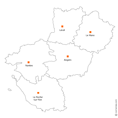
Ambulance en région Pays-de-la-Loire
495 sociétés d'ambulances sont référencés sur la région Pays-de-la-Loire
Vous recherchez une ambulance pour un transport de malade dans les Pays-de-la-Loire ?
La région Pays-de-la-Loire représente 7% des sociétés d'ambulances de France.
C'est le département de Loire-Atlantique qui compte le plus de sociétés d'ambulances dans les Pays-de-la-Loire.
C'est le département de Loire-Atlantique qui compte le plus de sociétés d'ambulances dans les Pays-de-la-Loire.
Ambulance dans le Maine-et-Loire (49)
Secteur de Segré-en-Anjou Bleu
Indice d'implantation
| Commune | Nb Pro | Habitants | Distance | |
|---|---|---|---|---|
| Segré - 49500 | 5 | 6925 | 0,0 | km |
| Vern-d'Anjou - 49220 | 2 | 5648 | 10,1 | km |
| le Lion-d'Angers - 49220 | 2 | 4465 | 13,4 | km |
| le Louroux-Béconnais - 49370 | 3 | 3016 | 18,7 | km |
| Candé - 49440 | 4 | 2916 | 19,1 | km |
| Pouancé - 49420 | 2 | 3031 | 23,4 | km |
Secteur de Saumur
Indice d'implantation
| Commune | Nb Pro | Habitants | Distance | |
|---|---|---|---|---|
| Saumur - 49400 | 3 | 27413 | 0,0 | km |
| Chacé - 49400 | 1 | 3 | 4,8 | km |
| Vivy - 49680 | 1 | 2506 | 7,7 | km |
| Saint-Clément-des-Levées - 49350 | 1 | 1157 | 11,5 | km |
| Brain-sur-Allonnes - 49650 | 1 | 1987 | 12,0 | km |
| Longué-Jumelles - 49160 | 1 | 6875 | 13,8 | km |
| Montreuil-Bellay - 49260 | 2 | 4030 | 14,9 | km |
| Doué-la-Fontaine - 49700 | 2 | 7584 | 16,2 | km |
| Vernantes - 49390 | 1 | 1975 | 18,0 | km |
| Vernoil-le-Fourrier - 49390 | 1 | 1256 | 18,7 | km |
| Mouliherne - 49390 | 1 | 883 | 24,4 | km |
Secteur de Cholet
Indice d'implantation
| Commune | Nb Pro | Habitants | Distance | |
|---|---|---|---|---|
| Cholet - 49300 | 6 | 53890 | 0,0 | km |
| la Tessoualle - 49280 | 2 | 3076 | 6,4 | km |
| le May-sur-Èvre - 49122 | 1 | 3953 | 8,6 | km |
| Trémentines - 49340 | 1 | 2823 | 9,6 | km |
| Maulévrier - 49360 | 1 | 3179 | 11,4 | km |
| la Plaine - 49360 | 1 | 1029 | 18,3 | km |
| Coron - 49690 | 1 | 1572 | 19,1 | km |
| Vihiers - 49310 | 1 | 7882 | 27,7 | km |
Secteur d'Angers
Indice d'implantation
| Commune | Nb Pro | Habitants | Distance | |
|---|---|---|---|---|
| Angers - 49000 | 4 | 150125 | 0,0 | km |
| Avrillé - 49240 | 1 | 12972 | 4,8 | km |
| les Ponts-de-Cé - 49130 | 1 | 12112 | 6,5 | km |
| Trélazé - 49800 | 1 | 13125 | 7,1 | km |
| Seiches-sur-le-Loir - 49140 | 2 | 2974 | 18,8 | km |
| Châteauneuf-sur-Sarthe - 49330 | 2 | 8 | 23,9 | km |
Secteur de Chalonnes-sur-Loire
Indice d'implantation
| Commune | Nb Pro | Habitants | Distance | |
|---|---|---|---|---|
| Chalonnes-sur-Loire - 49290 | 1 | 6528 | 0,0 | km |
| Saint-Georges-sur-Loire - 49170 | 2 | 3529 | 6,1 | km |
| la Possonnière - 49170 | 1 | 2416 | 6,5 | km |
| Beaulieu-sur-Layon - 49750 | 1 | 1416 | 14,2 | km |
| Thouarcé - 49380 | 2 | 5712 | 22,1 | km |
| Brissac-Quincé - 49320 | 1 | 3059 | 24,2 | km |
Secteur de Sèvremoine
Indice d'implantation
| Commune | Nb Pro | Habitants | Distance | |
|---|---|---|---|---|
| Saint-Macaire-en-Mauges - 49450 | 1 | 24970 | 0,0 | km |
| Beaupréau - 49600 | 2 | 22485 | 8,8 | km |
| Chemillé - 49120 | 3 | 21304 | 22,1 | km |
| la Pommeraye - 49620 | 1 | 18250 | 27,5 | km |
Secteur de Baugé-en-Anjou
Indice d'implantation
| Commune | Nb Pro | Habitants | Distance | |
|---|---|---|---|---|
| Baugé - 49150 | 1 | 11873 | 0,0 | km |
| Mazé - 49630 | 2 | 5578 | 15,7 | km |
| Noyant - 49490 | 1 | 1879 | 17,0 | km |
| Durtal - 49430 | 1 | 3382 | 17,7 | km |
Ambulance dans la Mayenne (53)
Secteur de Laval
Indice d'implantation
| Commune | Nb Pro | Habitants | Distance | |
|---|---|---|---|---|
| Laval - 53000 | 3 | 50479 | 0,0 | km |
| Nuillé-sur-Vicoin - 53970 | 1 | 1260 | 9,4 | km |
| Andouillé - 53240 | 1 | 2256 | 11,7 | km |
| Port-Brillet - 53410 | 2 | 1847 | 15,5 | km |
| Montsûrs - 53150 | 1 | 3 | 17,8 | km |
| le Bourgneuf-la-Forêt - 53410 | 1 | 1793 | 17,8 | km |
| Chailland - 53420 | 1 | 1237 | 18,5 | km |
| Meslay-du-Maine - 53170 | 1 | 2797 | 21,2 | km |
| Fromentières - 53200 | 1 | 830 | 24,4 | km |
| Juvigné - 53380 | 1 | 1486 | 26,2 | km |
| Château-Gontier - 53200 | 2 | 16 | 27,4 | km |
| Craon - 53400 | 3 | 4481 | 28,1 | km |
| Renazé - 53800 | 1 | 2626 | 37,2 | km |
| Saint-Aignan-sur-Roë - 53390 | 1 | 894 | 37,2 | km |
| Saint-Denis-d'Anjou - 53290 | 2 | 1549 | 39,8 | km |
Secteur de Mayenne
Indice d'implantation
| Commune | Nb Pro | Habitants | Distance | |
|---|---|---|---|---|
| Mayenne - 53100 | 2 | 13376 | 0,0 | km |
| Lassay-les-Châteaux - 53110 | 1 | 2393 | 17,6 | km |
| Bais - 53160 | 1 | 1264 | 19,5 | km |
| Évron - 53600 | 2 | 8 | 22,7 | km |
| Ernée - 53500 | 3 | 5786 | 23,8 | km |
| Villaines-la-Juhel - 53700 | 3 | 2930 | 25,5 | km |
| Sainte-Suzanne - 53270 | 2 | 1338 | 29,9 | km |
Secteur d'Ambrières-les-Vallées
Indice d'implantation
| Commune | Nb Pro | Habitants | Distance | |
|---|---|---|---|---|
| Ambrières-les-Vallées - 53300 | 2 | 2784 | 0,0 | km |
| Oisseau - 53300 | 1 | 1184 | 5,7 | km |
| Gorron - 53120 | 2 | 2683 | 13,5 | km |
| Javron-les-Chapelles - 53250 | 1 | 1413 | 21,7 | km |
| Saint-Berthevin-la-Tannière - 53220 | 1 | 359 | 23,3 | km |
| Fougerolles-du-Plessis - 53190 | 2 | 1281 | 26,6 | km |
| Landivy - 53190 | 2 | 1156 | 31,2 | km |
| Pré-en-Pail - 53140 | 1 | 2363 | 32,5 | km |
| Saint-Pierre-des-Nids - 53370 | 1 | 1946 | 39,2 | km |
Ambulance en Vendée (85)
Secteur de Herbiers
Indice d'implantation
| Commune | Nb Pro | Habitants | Distance | |
|---|---|---|---|---|
| les Herbiers - 85500 | 3 | 15933 | 0,0 | km |
| la Gaubretière - 85130 | 1 | 3016 | 8,6 | km |
| la Verrie - 85130 | 2 | 5 | 10,0 | km |
| Mouchamps - 85640 | 1 | 2821 | 10,9 | km |
| les Landes-Genusson - 85130 | 1 | 2271 | 12,8 | km |
| Mortagne-sur-Sèvre - 85290 | 1 | 5958 | 13,0 | km |
| Saint-Laurent-sur-Sèvre - 85290 | 2 | 3573 | 13,5 | km |
| Treize-Septiers - 85600 | 1 | 3053 | 20,6 | km |
| Cugand - 85610 | 1 | 3366 | 27,9 | km |
Secteur de Roche-sur-Yon
Indice d'implantation
| Commune | Nb Pro | Habitants | Distance | |
|---|---|---|---|---|
| la Roche-sur-Yon - 85000 | 10 | 52732 | 0,0 | km |
| Mouilleron-le-Captif - 85000 | 2 | 4829 | 5,8 | km |
| la Ferrière - 85280 | 1 | 5002 | 10,0 | km |
Secteur de Saint-Jean-de-Monts
Indice d'implantation
| Commune | Nb Pro | Habitants | Distance | |
|---|---|---|---|---|
| Saint-Jean-de-Monts - 85160 | 4 | 8349 | 0,0 | km |
| Notre-Dame-de-Monts - 85690 | 1 | 1997 | 7,0 | km |
| la Barre-de-Monts - 85550 | 1 | 2179 | 10,8 | km |
| Soullans - 85300 | 2 | 4202 | 12,1 | km |
| la Guérinière - 85680 | 2 | 1401 | 23,5 | km |
| Noirmoutier-en-l'Île - 85330 | 2 | 4587 | 27,8 | km |
Secteur de Talmont-Saint-Hilaire
Indice d'implantation
| Commune | Nb Pro | Habitants | Distance | |
|---|---|---|---|---|
| Talmont-Saint-Hilaire - 85440 | 1 | 7263 | 0,0 | km |
| Jard-sur-Mer - 85520 | 1 | 2644 | 6,4 | km |
| Longeville-sur-Mer - 85560 | 1 | 2455 | 10,8 | km |
| les Sables-d'Olonne - 85100 | 6 | 42 | 13,3 | km |
| Moutiers-les-Mauxfaits - 85540 | 1 | 2038 | 14,8 | km |
| Angles - 85750 | 1 | 2651 | 17,7 | km |
| le Champ-Saint-Père - 85540 | 1 | 1815 | 21,1 | km |
Secteur d'Aizenay
Indice d'implantation
| Commune | Nb Pro | Habitants | Distance | |
|---|---|---|---|---|
| Aizenay - 85190 | 1 | 8741 | 0,0 | km |
| Beaulieu-sous-la-Roche - 85190 | 1 | 2118 | 7,1 | km |
| Palluau - 85670 | 1 | 1085 | 7,3 | km |
| Saint-Paul-Mont-Penit - 85670 | 1 | 801 | 7,6 | km |
| le Poiré-sur-Vie - 85170 | 2 | 8298 | 8,2 | km |
| Apremont - 85220 | 1 | 1728 | 10,3 | km |
| la Mothe-Achard - 85150 | 1 | 2870 | 13,9 | km |
| Belleville-sur-Vie - 85170 | 2 | 5795 | 14,3 | km |
| Rocheservière - 85620 | 1 | 3065 | 23,1 | km |
Secteur de Fontenay-le-Comte
Indice d'implantation
| Commune | Nb Pro | Habitants | Distance | |
|---|---|---|---|---|
| Fontenay-le-Comte - 85200 | 3 | 13647 | 0,0 | km |
| Pissotte - 85200 | 1 | 1141 | 3,0 | km |
| Sérigné - 85200 | 1 | 995 | 4,7 | km |
| Saint-Hilaire-des-Loges - 85240 | 1 | 1960 | 10,8 | km |
| Maillezais - 85420 | 1 | 986 | 11,8 | km |
| Benet - 85490 | 2 | 3930 | 19,5 | km |
| la Châtaigneraie - 85120 | 1 | 2606 | 20,8 | km |
Secteur d'Essarts-en-Bocage
Indice d'implantation
| Commune | Nb Pro | Habitants | Distance | |
|---|---|---|---|---|
| les Essarts - 85140 | 1 | 8460 | 0,0 | km |
| Chavagnes-en-Paillers - 85250 | 4 | 3490 | 13,2 | km |
| les Brouzils - 85260 | 1 | 2702 | 14,3 | km |
| l'Herbergement - 85260 | 1 | 2989 | 18,6 | km |
| Montaigu - 85600 | 2 | 19 | 23,4 | km |
Secteur de Luçon
Indice d'implantation
| Commune | Nb Pro | Habitants | Distance | |
|---|---|---|---|---|
| Luçon - 85400 | 2 | 9361 | 0,0 | km |
| Nalliers - 85370 | 2 | 2313 | 10,8 | km |
| Saint-Michel-en-l'Herm - 85580 | 1 | 2313 | 12,9 | km |
| Chaillé-les-Marais - 85450 | 1 | 1921 | 13,0 | km |
| Sainte-Hermine - 85210 | 1 | 2857 | 14,1 | km |
| la Faute-sur-Mer - 85460 | 2 | 703 | 18,1 | km |
Secteur de Saint-Hilaire-de-Riez
Indice d'implantation
| Commune | Nb Pro | Habitants | Distance | |
|---|---|---|---|---|
| Saint-Hilaire-de-Riez - 85270 | 2 | 11169 | 0,0 | km |
| Saint-Gilles-Croix-de-Vie - 85800 | 2 | 7469 | 3,2 | km |
| le Fenouiller - 85800 | 1 | 4380 | 3,3 | km |
| Commequiers - 85220 | 2 | 3238 | 9,4 | km |
| Bretignolles-sur-Mer - 85470 | 1 | 4337 | 12,5 | km |
| Coëx - 85220 | 1 | 3127 | 14,2 | km |
Secteur de Sèvremont
Indice d'implantation
| Commune | Nb Pro | Habitants | Distance | |
|---|---|---|---|---|
| la Flocellière - 85700 | 0 | 6416 | 0,0 | km |
| Pouzauges - 85700 | 4 | 5536 | 5,9 | km |
| le Boupère - 85510 | 1 | 3072 | 6,7 | km |
| Saint-Mesmin - 85700 | 1 | 1740 | 10,7 | km |
| Montournais - 85700 | 1 | 1703 | 12,7 | km |
| Saint-Pierre-du-Chemin - 85120 | 1 | 1348 | 19,5 | km |
Secteur de Challans
Indice d'implantation
| Commune | Nb Pro | Habitants | Distance | |
|---|---|---|---|---|
| Challans - 85300 | 3 | 19501 | 0,0 | km |
| la Garnache - 85710 | 1 | 4663 | 6,2 | km |
| Beauvoir-sur-Mer - 85230 | 2 | 3942 | 14,6 | km |
| Bouin - 85230 | 1 | 2165 | 16,8 | km |
Secteur de Chantonnay
Indice d'implantation
| Commune | Nb Pro | Habitants | Distance | |
|---|---|---|---|---|
| Chantonnay - 85110 | 2 | 8271 | 0,0 | km |
| Saint-Germain-de-Prinçay - 85110 | 1 | 1507 | 4,4 | km |
| Saint-Vincent-Sterlanges - 85110 | 1 | 764 | 6,3 | km |
| Bournezeau - 85480 | 1 | 3265 | 10,5 | km |
| Mouilleron-en-Pareds - 85390 | 1 | 1816 | 15,7 | km |
Ambulance dans la Sarthe (72)
Secteur de Mans
Indice d'implantation
| Commune | Nb Pro | Habitants | Distance | |
|---|---|---|---|---|
| le Mans - 72000 | 10 | 144244 | 0,0 | km |
| Coulaines - 72190 | 2 | 7577 | 3,2 | km |
| la Chapelle-Saint-Aubin - 72650 | 2 | 2286 | 5,2 | km |
| Yvré-l'Évêque - 72530 | 1 | 4286 | 5,5 | km |
| Arnage - 72230 | 1 | 5143 | 7,6 | km |
| Étival-lès-le-Mans - 72700 | 2 | 1962 | 9,7 | km |
| Mulsanne - 72230 | 1 | 4772 | 10,3 | km |
| Champagné - 72470 | 1 | 3828 | 10,3 | km |
| la Bazoge - 72650 | 1 | 3661 | 12,0 | km |
| Louplande - 72210 | 2 | 1482 | 13,3 | km |
| Sainte-Jamme-sur-Sarthe - 72380 | 1 | 2105 | 16,6 | km |
| la Suze-sur-Sarthe - 72210 | 1 | 4398 | 17,7 | km |
| Ballon - 72290 | 2 | 2174 | 20,1 | km |
| Conlie - 72240 | 1 | 1865 | 21,8 | km |
| Beaumont-sur-Sarthe - 72170 | 1 | 2006 | 26,2 | km |
| Saint-Rémy-de-Sillé - 72140 | 1 | 835 | 30,5 | km |
| Sillé-le-Guillaume - 72140 | 2 | 2357 | 32,3 | km |
| Fresnay-sur-Sarthe - 72130 | 3 | 2066 | 34,8 | km |
| Sougé-le-Ganelon - 72130 | 1 | 887 | 39,8 | km |
| Oisseau-le-Petit - 72610 | 1 | 695 | 40,1 | km |
Secteur de Ferté-Bernard
Indice d'implantation
| Commune | Nb Pro | Habitants | Distance | |
|---|---|---|---|---|
| la Ferté-Bernard - 72400 | 3 | 9116 | 0,0 | km |
| Tuffé - 72160 | 1 | 1744 | 12,7 | km |
| Nogent-le-Bernard - 72110 | 1 | 954 | 12,7 | km |
| Montmirail - 72320 | 1 | 411 | 14,3 | km |
| Vibraye - 72320 | 2 | 2600 | 15,9 | km |
| Bonnétable - 72110 | 3 | 3915 | 16,5 | km |
| Saint-Cosme-en-Vairais - 72110 | 1 | 1996 | 16,8 | km |
| Dollon - 72390 | 2 | 1501 | 17,3 | km |
| Thorigné-sur-Dué - 72160 | 3 | 1611 | 18,6 | km |
| Marolles-les-Braults - 72260 | 1 | 2 | 25,8 | km |
| Mamers - 72600 | 1 | 5363 | 27,4 | km |
| Saint-Calais - 72120 | 1 | 3349 | 30,5 | km |
Secteur de Changé
Indice d'implantation
| Commune | Nb Pro | Habitants | Distance | |
|---|---|---|---|---|
| Changé - 72560 | 1 | 6407 | 0,0 | km |
| Parigné-l'Évêque - 72250 | 2 | 4842 | 8,5 | km |
| Savigné-l'Évêque - 72460 | 2 | 4064 | 9,9 | km |
| Montfort-le-Gesnois - 72450 | 1 | 3038 | 11,8 | km |
| Lombron - 72450 | 1 | 1933 | 14,3 | km |
| Connerré - 72160 | 1 | 2875 | 17,6 | km |
| Écommoy - 72220 | 1 | 4658 | 17,9 | km |
| le Grand-Lucé - 72150 | 1 | 1935 | 19,5 | km |
| Bouloire - 72440 | 1 | 2106 | 20,4 | km |
| Mayet - 72360 | 1 | 3223 | 25,3 | km |
| Lhomme - 72340 | 1 | 860 | 34,0 | km |
| Château-du-Loir - 72500 | 2 | 4750 | 34,1 | km |
| la Chartre-sur-le-Loir - 72340 | 2 | 1460 | 36,1 | km |
Secteur de Flèche
Indice d'implantation
| Commune | Nb Pro | Habitants | Distance | |
|---|---|---|---|---|
| la Flèche - 72200 | 2 | 14992 | 0,0 | km |
| Saint-Jean-de-la-Motte - 72510 | 1 | 884 | 10,8 | km |
| Malicorne-sur-Sarthe - 72270 | 1 | 1934 | 13,0 | km |
| Mansigné - 72510 | 1 | 1603 | 16,5 | km |
| le Lude - 72800 | 3 | 3899 | 17,8 | km |
| Cérans-Foulletourte - 72330 | 1 | 3288 | 18,1 | km |
| Vaas - 72500 | 2 | 1536 | 29,3 | km |
Secteur de Sablé-sur-Sarthe
Indice d'implantation
| Commune | Nb Pro | Habitants | Distance | |
|---|---|---|---|---|
| Sablé-sur-Sarthe - 72300 | 4 | 12575 | 0,0 | km |
| Parcé-sur-Sarthe - 72300 | 1 | 2151 | 9,8 | km |
| Brûlon - 72350 | 1 | 1577 | 15,8 | km |
| Noyen-sur-Sarthe - 72430 | 3 | 2660 | 17,8 | km |
| Loué - 72540 | 2 | 2207 | 21,6 | km |
Ambulance en Loire-Atlantique (44)
Secteur de Nantes
Indice d'implantation
| Commune | Nb Pro | Habitants | Distance | |
|---|---|---|---|---|
| Nantes - 44000 | 11 | 292718 | 0,0 | km |
| Saint-Sébastien-sur-Loire - 44230 | 1 | 25610 | 3,9 | km |
| Rezé - 44400 | 4 | 39568 | 3,9 | km |
| Sainte-Luce-sur-Loire - 44980 | 4 | 14170 | 6,2 | km |
| Bouguenais - 44340 | 1 | 18662 | 6,7 | km |
| Basse-Goulaine - 44115 | 1 | 8361 | 6,7 | km |
| Saint-Herblain - 44800 | 6 | 43784 | 7,2 | km |
| Orvault - 44700 | 1 | 24922 | 7,5 | km |
| Vertou - 44120 | 3 | 22820 | 8,3 | km |
| la Chapelle-sur-Erdre - 44240 | 2 | 18412 | 8,8 | km |
| Carquefou - 44470 | 1 | 18646 | 9,8 | km |
| Thouaré-sur-Loire - 44470 | 2 | 8750 | 10,0 | km |
| Sautron - 44880 | 1 | 6968 | 10,1 | km |
| Saint-Aignan-Grandlieu - 44860 | 1 | 3779 | 12,2 | km |
| Saint-Jean-de-Boiseau - 44640 | 1 | 5449 | 13,0 | km |
| Couëron - 44220 | 1 | 20084 | 13,2 | km |
| Bouaye - 44830 | 1 | 6555 | 13,5 | km |
| le Pellerin - 44640 | 1 | 4719 | 15,3 | km |
Secteur de Châteaubriant
Indice d'implantation
| Commune | Nb Pro | Habitants | Distance | |
|---|---|---|---|---|
| Châteaubriant - 44110 | 2 | 11866 | 0,0 | km |
| Rougé - 44660 | 1 | 2240 | 9,0 | km |
| Moisdon-la-Rivière - 44520 | 2 | 1944 | 10,9 | km |
| Saint-Vincent-des-Landes - 44590 | 2 | 1514 | 11,4 | km |
| Issé - 44520 | 1 | 1855 | 12,2 | km |
| Saint-Julien-de-Vouvantes - 44670 | 1 | 936 | 13,4 | km |
| Derval - 44590 | 4 | 3478 | 22,7 | km |
Secteur de Pornic
Indice d'implantation
| Commune | Nb Pro | Habitants | Distance | |
|---|---|---|---|---|
| Pornic - 44210 | 3 | 14288 | 0,0 | km |
| la Bernerie-en-Retz - 44760 | 3 | 2611 | 6,4 | km |
| la Plaine-sur-Mer - 44770 | 1 | 3977 | 6,9 | km |
| Saint-Michel-Chef-Chef - 44730 | 1 | 4535 | 7,8 | km |
| Préfailles - 44770 | 1 | 1224 | 8,8 | km |
| Bourgneuf-en-Retz - 44580 | 1 | 4851 | 14,3 | km |
| Sainte-Pazanne - 44680 | 1 | 6074 | 22,4 | km |
Secteur de Pontchâteau
Indice d'implantation
| Commune | Nb Pro | Habitants | Distance | |
|---|---|---|---|---|
| Pontchâteau - 44160 | 4 | 10191 | 0,0 | km |
| Missillac - 44780 | 1 | 5076 | 7,2 | km |
| Sainte-Reine-de-Bretagne - 44160 | 1 | 2245 | 7,7 | km |
| Saint-Gildas-des-Bois - 44530 | 2 | 3617 | 9,9 | km |
| Guenrouet - 44530 | 2 | 3254 | 14,0 | km |
Secteur de Saint-Nazaire
Indice d'implantation
| Commune | Nb Pro | Habitants | Distance | |
|---|---|---|---|---|
| Saint-Nazaire - 44600 | 4 | 68513 | 0,0 | km |
| Trignac - 44570 | 2 | 7298 | 4,7 | km |
| Montoir-de-Bretagne - 44550 | 1 | 7051 | 7,4 | km |
| Pornichet - 44380 | 1 | 10531 | 9,0 | km |
| Donges - 44480 | 1 | 7330 | 11,8 | km |
| la Chapelle-des-Marais - 44410 | 1 | 3965 | 18,8 | km |
Secteur de Machecoul-Saint-Même
Indice d'implantation
| Commune | Nb Pro | Habitants | Distance | |
|---|---|---|---|---|
| Machecoul - 44270 | 5 | 7267 | 0,0 | km |
| Saint-Mars-de-Coutais - 44680 | 1 | 2587 | 14,9 | km |
| Corcoué-sur-Logne - 44650 | 1 | 2718 | 18,9 | km |
| Legé - 44650 | 2 | 4498 | 20,8 | km |
Secteur de Savenay
Indice d'implantation
| Commune | Nb Pro | Habitants | Distance | |
|---|---|---|---|---|
| Savenay - 44260 | 1 | 8100 | 0,0 | km |
| Prinquiau - 44260 | 2 | 3382 | 5,3 | km |
| Campbon - 44750 | 2 | 3904 | 6,0 | km |
| le Temple-de-Bretagne - 44360 | 1 | 1873 | 11,9 | km |
| Saint-Étienne-de-Montluc - 44360 | 2 | 6627 | 15,4 | km |
Secteur de Loireauxence
Indice d'implantation
| Commune | Nb Pro | Habitants | Distance | |
|---|---|---|---|---|
| Varades - 44370 | 1 | 7310 | 0,0 | km |
| Mésanger - 44522 | 1 | 4623 | 16,2 | km |
| Saint-Mars-la-Jaille - 44540 | 1 | 2417 | 19,5 | km |
| le Cellier - 44850 | 1 | 3705 | 24,9 | km |
| Riaillé - 44440 | 2 | 2239 | 25,0 | km |
| Ligné - 44850 | 2 | 4859 | 26,4 | km |
Secteur de Guérande
Indice d'implantation
| Commune | Nb Pro | Habitants | Distance | |
|---|---|---|---|---|
| Guérande - 44350 | 1 | 15858 | 0,0 | km |
| la Baule-Escoublac - 44500 | 1 | 15456 | 6,3 | km |
| le Pouliguen - 44510 | 1 | 4647 | 6,3 | km |
| la Turballe - 44420 | 1 | 4521 | 6,6 | km |
| le Croisic - 44490 | 1 | 4036 | 7,6 | km |
| Assérac - 44410 | 1 | 1797 | 11,6 | km |
| Herbignac - 44410 | 1 | 6307 | 15,9 | km |
| Camoël - 56130 | 1 | 967 | 17,2 | km |
Secteur de Clisson
Indice d'implantation
| Commune | Nb Pro | Habitants | Distance | |
|---|---|---|---|---|
| Clisson - 44190 | 3 | 6662 | 0,0 | km |
| Gétigné - 44190 | 1 | 3532 | 2,8 | km |
| Boussay - 44190 | 2 | 2677 | 8,6 | km |
| Vieillevigne - 44116 | 2 | 3941 | 17,3 | km |
Secteur de Nort-sur-Erdre
Indice d'implantation
| Commune | Nb Pro | Habitants | Distance | |
|---|---|---|---|---|
| Nort-sur-Erdre - 44390 | 1 | 8272 | 0,0 | km |
| Saint-Mars-du-Désert - 44850 | 1 | 4396 | 11,0 | km |
| Héric - 44810 | 3 | 5661 | 11,6 | km |
| Vigneux-de-Bretagne - 44360 | 1 | 5628 | 21,7 | km |
Secteur de Saint-Brevin-les-Pins
Indice d'implantation
| Commune | Nb Pro | Habitants | Distance | |
|---|---|---|---|---|
| Saint-Brevin-les-Pins - 44250 | 2 | 13134 | 0,0 | km |
| Saint-Père-en-Retz - 44320 | 1 | 4273 | 10,0 | km |
| Paimbœuf - 44560 | 1 | 3260 | 10,5 | km |
| Frossay - 44320 | 1 | 3118 | 17,2 | km |
Secteur de Vallet
Indice d'implantation
| Commune | Nb Pro | Habitants | Distance | |
|---|---|---|---|---|
| Vallet - 44330 | 2 | 8625 | 0,0 | km |
| le Loroux-Bottereau - 44430 | 2 | 7879 | 10,3 | km |
| Saint-Julien-de-Concelles - 44450 | 1 | 6813 | 13,7 | km |
Secteur de Blain
Indice d'implantation
| Commune | Nb Pro | Habitants | Distance | |
|---|---|---|---|---|
| Blain - 44130 | 1 | 9543 | 0,0 | km |
| Bouvron - 44130 | 1 | 3018 | 9,2 | km |
| Nozay - 44170 | 3 | 3956 | 14,2 | km |
Secteur de Saint-Philbert-de-Grand-Lieu
Indice d'implantation
| Commune | Nb Pro | Habitants | Distance | |
|---|---|---|---|---|
| Saint-Philbert-de-Grand-Lieu - 44310 | 1 | 8619 | 0,0 | km |
| Geneston - 44140 | 2 | 3628 | 10,0 | km |
| Pont-Saint-Martin - 44860 | 1 | 5640 | 10,7 | km |